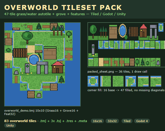
preview/cover.png). Top: the 10×10 demo map it paints. Middle: the packed sheet (255×84, 1 draw call). Bottom: the corner-fill strip — 16 bases become 47 filled grass/water tiles, no missing shoreline diagonals.The 3-step recipe
- Sort tiles by pixel size — one layer per size. Keep 16×16 grass (16 bases) and 16×16 grove (12: sand, dirt paths, cliff top/face, tree, pine, bush, flowers, rock) separate from 32×32 features (8: big oak, pine cluster, cliff block, pond, log bridge, cabin, rock arch, shrine stone). Do not scale one to match the other — scaling bleeds hard pixel edges. In the map file keep the map at 16px and give the features layer its own 32px size properties (
Grass16 + Grove16 + Feat32in ouroverworld_demo.tmj). The editor opens and displays it; native per-layer re-render is still the editor's unsolved ask (Tiled#149), so treat this as a portable data convention. - Fill the 16-tile blob base to 47 shoreline corners. The 16 bases are the 4-bit edge combinations (tile id = neighbour mask: N=1 E=2 S=4 W=8). Paint a diagonal-only shoreline touch — two grass areas meeting at one corner pixel over water — and the base shows a water notch: there is no tile for it. The fix is 31 quadrant-composited variants (stamp top-left / top-right / bottom-left / bottom-right quadrants from different donor bases) so every outer diagonal (Godot#31003 gap) paints a clean shore. Check: hash all 47 outputs and require 47 unique — a repeated hash means two corners share a donor pair. Our bench note records ~120 min by hand vs ~3 min generated (40×); time one hand run on your own set before believing any ratio.
- Pack to one sheet, then gate before you trust it. Shelf-pack everything on one RGBA sheet (ours 255×84) with a manifest (per-tile name + rect + frame order + per-layer sizes + autotile record). Verify every rect sits inside the sheet and none overlap — that is the no-bleed guarantee. Then re-parse every data file: region sizes match the manifest, zero bad image refs, Godot TileSet ASCII-only. Paint a 10×10 test map (grass + grove + features) and hunt shorelines: every outer corner shows grass or water edge, never background. That test is free and works on any seller's set.
| Symptom | Cause | Fix |
|---|---|---|
| Diagonal holes in grass/water shores | 16-tile base has no outer-diagonal tile | 31 quadrant composites (16→47); hash-check 47 unique |
| 32px cabin/trees drift on 16px map | One tile size per map (Tiled#149) | One layer per size; Feat32 layer carries its own 32px properties |
| Blurry tiles in Godot | Default smoothing | Filter: Nearest + Reimport, integer scale only |
| TMX opens with missing image | Image filename mismatch | Keep shipped folder layout so ../ refs resolve |
| Import "works nowhere" | Wrong engine path/version | Tiled 1.10 open .tmj; Godot 4 open .tres with res://assets/... paths; Unity PPU 16 + Point per guide |
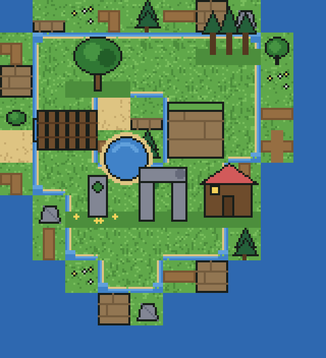
shot-map.png, vendored): the 10×10 demo map — Grass16 + Grove16 + Feat32 — rendered from shipped tiles. If your map looks like this after step 3, your shores survived.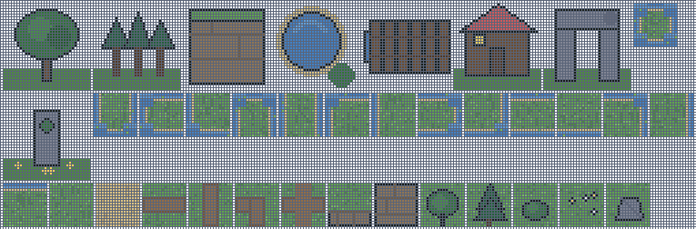
shot-sheet.png, vendored): 36 input tiles shelf-packed to 255×84 + manifest with 36 name+rect+order entries, verified no-overlap. One draw call.
shot-feats.png, vendored): 8 chunky 32px set-pieces that read next to 16px grass. Thick outlines — thin lines vanish at this pairing.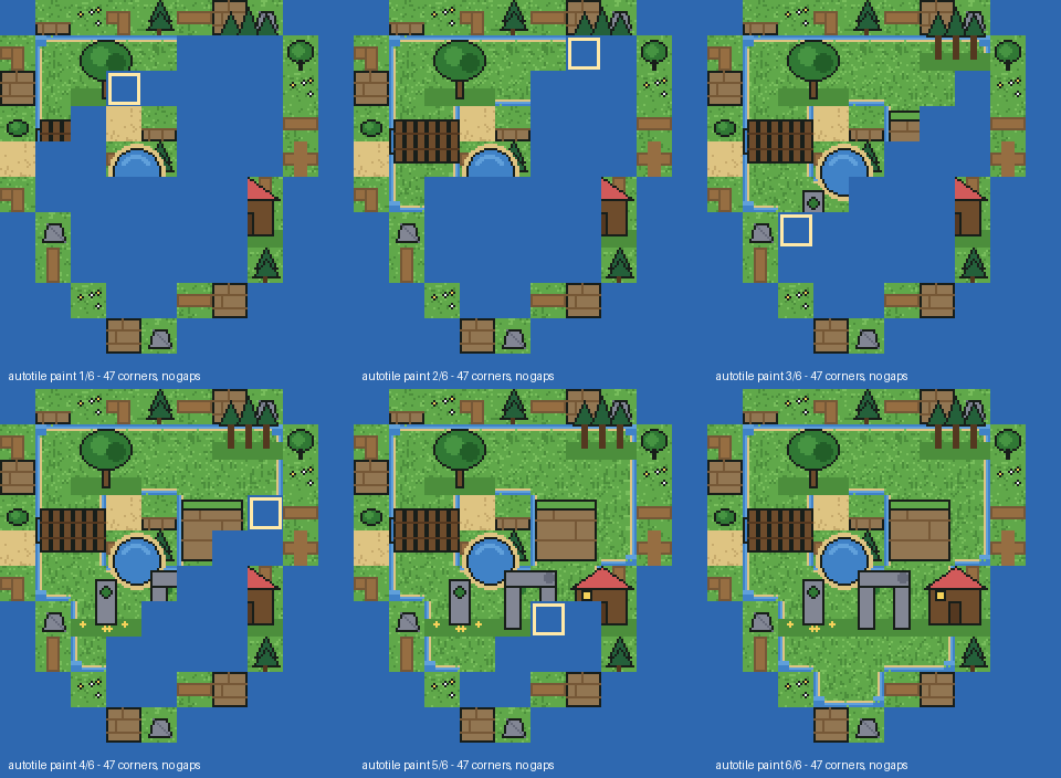
demo.gif, 6 frames, vendored): autotile paint sweep with water wash and corner highlight, rendered from shipped output — not a mockup.Free helper: blob-mask → tile picker
Click which orthogonal neighbours are grass (N/E/S/W). Then tick any diagonal-only shoreline touches (NE/SE/SW/NW). The helper shows the 4-bit mask, the Vol 0 base tile, whether the touch needs a Vol 2 composite — and a copy-paste Tiled snippet. Everything runs locally — nothing leaves your device.
Related free tools
- Tileset Splitter & Converter — verify any overworld sheet's grid and export TMX/TSX/JSON/CSV (try the Vol 0 base: 16×16, no margin).
- Get a tileset PNG into Tiled + Godot 4 — the companion 8-minute recipe (exact grid → TSX/TMX → Nearest import).
- Fix dungeon autotile outer corners — the series sibling (Vol 1): same 16→47 recipe on torchlit dungeon floors.
- Import a sprite sheet into Godot 4 — the 5-minute sprite recipe (grid → Nearest filter → SpriteFrames).
- Palette Extractor — pull exact grass/water/sand/path greens and blues from a tile for matching features.
- All free game-dev tools